Karakalpakstan (Karakalpak: Qaraqalpaqstan
/ Қарақалпақстан; Uzbek: Qoraqalpogʻiston), officially the Republic of Karakalpakstan
(Karakalpak: Qaraqalpaqstan
Respublikası / Қарақалпақстан
Республикасы; Uzbek: Qoraqalpogʻiston
Respublikasi), is an autonomous republic within
Uzbekistan. It occupies the whole northwestern end of
Uzbekistan. The capital is Nukus (Noʻkis / Нөкис). The Republic of Karakalpakstan
has an area of 160,000 square kilometres (62,000 sq mi). Its
territory covers the classical land of Khwarezm, though in classical Persian literature the
area was known as Kāt (کات). The name
"Karakalpak" comes from two words: "qara" meaning black and
"qalpaq" meaning hat.
Karakalpakstan is now mostly desert and is
located in western Uzbekistan near the Aral Sea, in the lowest part of the Amu
Darya basin. It has an area of 164,900 km² and is surrounded by desert.
The Kyzyl Kum Desert is
located to the east and the Karakum Desert is located to the south. A rocky plateau
extends west to the Caspian Sea. Other than the capital Nukus,
large cities include Xojeli (Cyrillic: Ходжейли), Taxiatosh (Тахиаташ), Shimbai (Шымбай), Konirat (Қоңырат) and Moynaq (Муйнак), a former Aral Sea port now completely dried up according to NASA.
The Karakalpak population
is mainly confined to the central part of Karakalpakstan that is irrigated by the Amu Darya. The largest communities live in Nukus,
the capital of Karakalpakstan and the surrounding large towns, such as
Khodzheli, Shimbay, Takhtaitash, Shomanay and Kungrad. Rural Karakalpaks mainly
live on former collective or state farms, most of which have been recently
privatised.
Many rural Karakalpaks
have been seriously affected by the desiccation of the Aral Sea, which has destroyed the local fishing industry along
with much of the grazing and agricultural land in the north of the delta.
Karakalpaks have nowhere to go. The majority of Karakalpakstan is occupied by
desert - the Kyzyl Kum on the eastern side, the barren Ustyurt plateau to
the west, and now the growing Aral Kum to the north, once the bed of the former
Aral Sea. Although their homeland bears
their name, the Karakalpaks are not the largest ethnic group living in
Karakalpakstan. They are increasingly being outnumbered by Uzbeks, many of whom
are being encouraged to move into the rich agricultural region around Turtkul and Beruni.
The Karakalpak language
belongs to the Kipchak-Nogai group of Turkic languages, which also includes Kazakh and Nogai. Spoken Karakalpak has two dialects: Northeastern and
Southwestern. Written Karakalpak uses both a modified form of the Cyrillic alphabet and Latin alphabet, with the former being standard during the Soviet Union and the latter modelled on Uzbekistan's alphabet
reform for Uzbek. Before the Soviet
Union, Karakalpak was rarely written, but when it was it used a modified form
of the Perso-Arabic alphabet. Due
to the geography and history of the Karakalpak people, Karakalpak has been
influenced by Uzbek, Mongol, Tajik, and Russian. A Karakalpak-Uzbek pidgin language is often spoken by those bilingual in both languages.
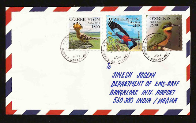
The covers posted on 15 January 2018 and I received on 05 February 2018. There is no special postage stamps for Karakalpakstan, still I found some stamps which is related to the region, Luckily I got two stamps with the map of Karakalpakstan and it is written as 'Qoroqolpokston Respublikasi" in Uzbek language.


No comments:
Post a Comment
Note: only a member of this blog may post a comment.